Paper Maps
Hough Neighborhood Property Status

Cleveland's Hough neighborhood has experienced significant decline since the 1960's that continues today. The 2008 foreclosure crisis accelerated the amount of vacant and blighted housing. The Land Bank works in this area to acquire land and property to further stabilization efforts. This map shows individual parcels with colorized statuses. The green statuses are municipally-owned and the blue are in a trajectory to be acquired by the Cuyahoga Land Bank. The rest of the statuses indicate where the property is in the foreclosure pipeline.
Property Status Around Local Church

Churches often act as anchors for neighborhoods. They provide activities, vital services, and housing to local residents. This particular church work with the Land Bank to acquire surrounding properties and support stabilization and demolition efforts of vacant and blighted houses.
Neighborhoods and Wards of Cleveland
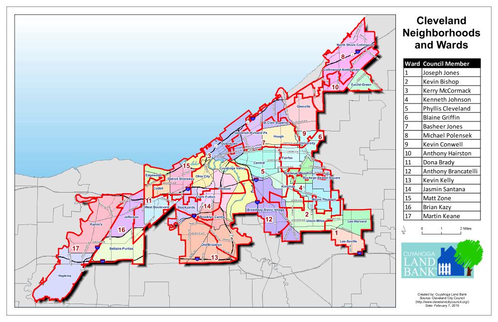
The Land Bank works very closely with city council members on various neighborhood projects. I created this map as a quick reference for Land Bank staff to give a better idea of the areas we serve and who our contacts are.
Countywide Renovation Typology and Distribution
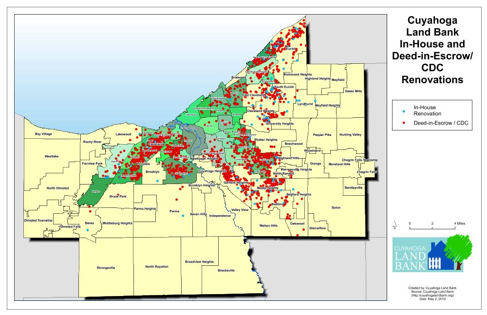
While the majority of the Land Bank's operations are demolition of vacant and blighted structures, about 40% of the work is renovation. This shows the distribution of the renovations across Cuyahoga County and the two types of renovations. The majority are done through the Deed-in-Escrow Program.
The Book Index
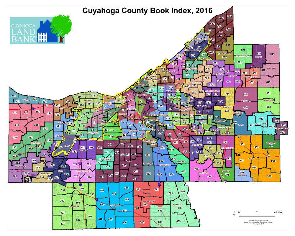
Every property in Cuyahoga County has a unique permanent parcel number. This is more efficient for Land Bank staff to use as opposed to mailing addresses, which can be incorrect, decommissioned, or confusing when properties have multiple addresses. The parcel numbers also make GIS functions run much more smoothly. This map shows how the parcel numbers are geographically organized throughout the county, which aids Land Bank Staff. The numbers on the map are the first three numbers of the 10-digit parcel number and corresponds to a specific page in the map books at the County Map Room.
Web Maps
Assemblages of Large Tracts of Vacant Land
Aside from the common demolition and renovation programs, the Land Bank has a unique ability to transact and acquire land. Many for-profit and non-profit companies come forth looking to acquire large tracts of vacant land for various reasons. This particular map was made using ArcGIS online for a construction company.
Vacant Land Assemblages in Specific Geographies
This is another example of a company looking to expand their footprint. The search criteria included specific geographies along commercial corridors. Foreclosure pipeline and municipal ownership are color coded for readability.
Sailboat Repair Facility Search
I created a slideshow map for a company that needed a large amount of space for sailboat repairs. The map allows the user to scroll through the candidates, rather than panning and zooming throughout the entire area.
City of Euclid Primary Investment Area
The City of Euclid, a streetcar suburb bordering Cleveland has also experienced decline and abandonment since the 2008 foreclosure crisis. City Council identified an area where stabilization and renovation efforts would have the biggest impact. I created this map to aid Euclid City Council in identifying renovation candidates.
